Sunday, October 9, 2016

Bidding farewell to Ireland

Today we leave Ireland and fly to Toronto, then take the train to London, Ontario to spend Thanksgiving with dear old friends. So since we won’t be doing anything interesting to report, we thought we’d give you a few observations from our time in Ireland.

Driving:
In Canada, signs give you the appropriate speed for the road ahead. If there are dangerous curves, there’s a dangerous curve sign and a 30 kmh sign to go with it. Here, there are just maximum speed signs — it’s up to you to slow down if you think you need to.

So everything is 100 kmh or 80 kmh unless you’re going through a town, where it is 60 or 50. Usually just before a tight curve, there will be a 100 kmh sign, just to dare you to try it. 

Then there’s the sign “Hidden Dip”, which encourages you to find it if you can. Why not just mark where it is? “Dip in 20 metres.” That would be helpful. “See if you can find a dip” is not.

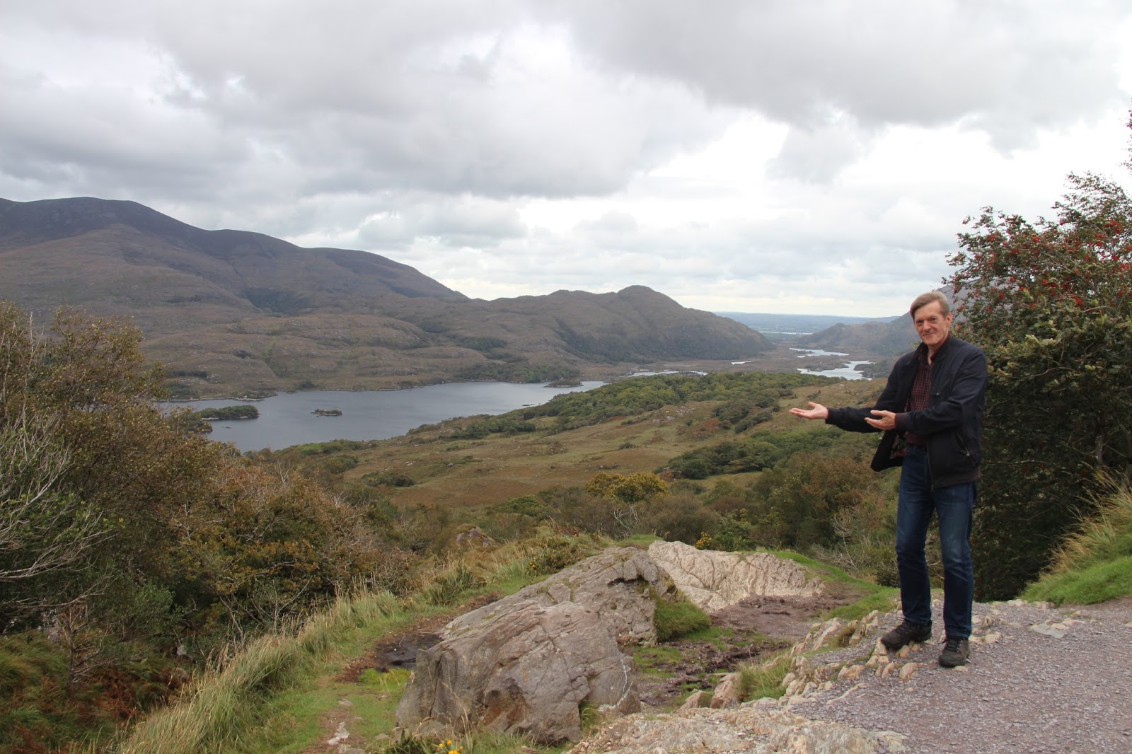
Our satnav (GPS), Colleen sent us on some spectacularly narrow roads. Roads that would have made nice wide footpaths back home. And despite the fact that they could in no way accommodate two-way traffic, they were posted at 80 kmh. Insane!

This isn’t just a matter of foreigners complaining — the locals have been calling for a complete revamping of the signage for some time now.

Food:
The food in Ireland is wonderful. One thing that surprised and delighted us was the quality of the food in the museums and other tourist attractions. Back home, you do not expect food to taste homemade at a food counter in a tourist attraction. But we had lovely cakes and delicious tea served by cheery, chatty people everywhere we went. Even at the Gap of Dunloe, where it’s all about nature and hiking, there’s a pub and a lovely tea room with delectable baked treats.

And yogurt! The Irish yogurt is divine. I had a 7% fat rhubarb yogurt from Cork that was just amazing!

Smells:
People still burn peat here, and you can buy peat briquettes everywhere. In the evening, the smell of peat burning in fireplaces is homey and nostalgic. The main peat company promises it will “create that homely feeling you can only get with the scent of burning real Irish peat.” In a gift store, I found little cardboard houses with peat inside that you can burn like incense to make your home smell like you’re still in Ireland.

Colours:
Green. I have never seen grass this green.
Front doors are brightly coloured, often with a centred doorknob.

Accommodations;
Fred did an amazing job of booking great rooms for us. They all had some fun quirks to get used to: the light switches are backwards to ours. The electrical plugs have on-off switches. The toilets make weird noises. The door latches have faces.

People:
Every Irish person we encountered was friendly and cheery. We also enjoyed the regional expressions and turns of phrase. In County Mayo we often heard “You’re all right,” which can mean, “That’s OK” or “Don’t worry about it” — or if used as a question (“Are you all right?) it means “How are you?”. Also, Irish people everywhere say “half-10” to mean 10:30, which was a little confusing at first. 

Wildlife:
Sheep and cows are everywhere. We particularly enjoyed the sheep on Achill Island, though, as they were even on the roads. And the sheep are in fun colours! We saw hundreds of them with purple, blue, pink, and orange markings (we assume it’s dye used as branding).


Saturday, October 8, 2016

Tea room at the Famine Museum


Off to an early start this morning, and on the road a little after 8:30. Our first stop was the Famine Museum in Strokestown. Lots of interesting information here about the economic and social conditions that made the failure of the potato crop so catastrophic. Not a lot of artifacts, as one might imagine, but the story was captured very fully, and it was an interesting stop.

The next stop was to be Newgrange — a 5,200-year-old passage tomb, older than Stonehenge. Built by Stone Age farmers, the mound is 85 metres in diameter and 13.5 metres high — an area of about an acre. A 19-metre passage leads into a chamber with three alcoves. The passage and chamber are aligned with the rising sun at the winter solstice. It’s all surrounded by 97 large stones, some of which are carved with megalithic art. Sounds amazing, right? And we were really looking forward to seeing it. 

The thing is, there was a fatal crash somewhere on the road ahead of us, and the Garda (Ireland’s version of our RCMP) closed the highway. So we had to take a complicated detour that cost quite a bit of time. 

Cute town on our detour
So eventually, we had to make the decision to save this experience for another time. If we had only known, we’d have gladly forgone the Famine Museum, but there you have it. It’s another very good reason to come back.

So on we went to Dublin to check into our B&B in the suburb of Swords. To our delight, there is a castle here, so we had a look through that. Not quite as exciting as Newgrange, but it was something!! 

Swords Castle (more of a palace than a fortress) was built by the Archbishop of Dublin in 1200 as a residence and administrative centre.The chapel has been undergoing reconstruction, including the addition of a new oak beamed roof. New tiles made using traditional methods were based on those found during the 1971 excavations. New windows have also been inserted.


Those excavations revealed that the castle was built on a graveyard that dates from the 11th century. They found the remains of 17 people, and most of them were adolescents. They are hoping for more information once radio carbon dating is done.

Our B&B is close to the airport, so it will be a relatively stress-free exercise in the morning to drop the car off and get to our flight. One very welcome feature at this B&B is a kittycat named Mr. Biggles. He hopped up on the bed and cuddled with me for a bit, purring like crazy as I scritched him under the chin. Pssst Caitlin, don’t tell Sasha!


Friday, October 7, 2016

Genealogy, shopping, and country life


Today, Fred drove to Castlebar to visit the library and ferret out more genealogical information. I walked down to the town and visited some shops. I bought some souvenirs, wee gifts for friends, and a nice gift for myself — a hand-made penannular brooch. 

We caught up with each other on the street a little after 12, went for tea and cake at our favourite coffee shop, then visited the Museum of Country Life in Turlough. It’s one of Ireland’s four national museums, and the only one outside of Dublin.

It was a fascinating museum, and like all the Irish national museums, free of charge. We learned about traditional ways of life in Ireland from the early 1800s. 

We loved seeing the intricate baskets people made out of available plant material — they made everything out of it, including horse collars and saddles, hen nests and furniture made of straw, boats made of woven reeds, and lobster traps made of heather twigs. We both tried out a woven straw chair, and found it very comfortable.


Woven hen nest
We saw different thatching materials and techniques for roofs, and learned about Irish folk architecture; we learned about household tools and cooking techniques, and how they grew their potatoes; and we discovered lots of interesting details on the way people lived, including their folklore and superstitions. For example, the woman of the house would use metal tongs to tend the fire. If she had to leave the house for any reason, she would lay the tongs across the baby’s cradle so fairies wouldn’t steal the baby. 

One thing the museum displays really emphasized was that for the majority of Irish people in the 1800s, life was hard. The craft techniques that are considered a bit chic today, like basket weaving and rope making, were a matter of day-to-day survival for Irish farm people in the 19th century.


We ended the day with a walk to town and a bite to eat in Cobbler’s Bar (the left bit of the yellow building pictured below). The space used to be the local cobbler’s shop, but when he retired, the hotel next door took it over.


Thursday, October 6, 2016

Achill Island

We had a fabulous day that began with a huge breakfast at our B&B. Fruit, yogurt, cereal, a hot breakfast of egg, black and white pudding, sausage, grilled tomato and mushrooms, toast, and the best soda bread I’ve had in Ireland (and we’ve eaten it every day).

When I complimented our host Margaret on it, she gave me her recipe. The first two ingredients are Odlum flours! How nice to know that she considers my family’s flour to be the best you can buy! I’m so delighted to have the recipe, and can’t wait to make it at home.

We dropped clothes off at the laundry, which is located just paces from the door, then set out for Achill Island, Ireland’s largest island. It’s almost not an island at all, as it’s connected to the mainland by a short bridge — maybe 250 metres long.

The drive around the island has plenty of viewpoints, and our first stops were overlooking the wild Atlantic Ocean — waves crashing over the rocks below us. Absolutely magnificent! I couldn’t stop taking photos!


A little further along (and after some crazy switchbacks in the road), we hit a long sandy beach, which we walked on for some time. 

I loved seeing how it was decorated with rocks of various sizes and colours. It seemed to me to be artwork that must change daily with the tide. I took photos but didn’t move any of the stones. Who am I to interfere with such a masterpiece?

After these wild beaches, we found calm beaches on the other side of the island — long stretches of lovely sand.

We continued around the island until we came to the abandoned village on the southern slopes of Slievemore Mountain. 


Some 80 to 100 ruined stone cottages occupy a mile-long stretch of road. The village has been uninhabited since the mid 1800s. Settlement in this area dates back to at least early Medieval times, but archaeologists have found artefacts and megalithic tombs dating from the Neolithic period, some 5,000 years ago. An amazing, enigmatic place.

After exploring the abandoned village, we headed back to Westport Harbour, where we had tea and cake. I was pleased to see the same server who served me yesterday, because I was able to greet her like a local: “Are ye all right?” She said it to me yesterday and had to explain that it’s the local greeting — I thought maybe I was looking pale or something.

Later, we walked down to the town and shared a bite to eat. A fine end to a spectacular day.


Wednesday, October 5, 2016

Westport, County Mayo

Our day began with the drive from Galway to the pretty little seaside town of Westport. We were expecting the trip to be mostly highway, but our SatNav (Colleen) guided us through back roads and rabbit lanes — or at least that’s how they appeared to us. I’m convinced that she thinks we don’t like to go on the highways.

In any case, we arrived in the late morning, too early to get into our B&B. So we walked around a bit, checked out the harbour and a quirky little museum. Next, we went ancestor hunting. Our first stop was the old parish church at Turlough, the parish of Fred’s Irish ancestors, the Kimlins. We walked through the cemetery but did not find any relatives there. 

Next, we went in search of the farm hamlet of Cloonkesh, which Colleen didn’t even recognize as a place (a shopkeeper in Turlough gave us directions). We found a wee sign with the name and an arrow, and followed it to a farmer’s property, where we stopped and wandered around a bit.

The treasure we were hunting was any evidence of the little farmhouse of Fred’s maternal great-grandfather, William Kimlin. We had a good look around, and figured it must be long gone. Just as we were getting back in the car, along came the farmer.

He wanted to know what we were doing taking photos. We told him, and he knows where the ruins are of Fred's great-great grandfather's house!

So he explains very clearly (three times to be sure) how to go through this gate, walk down the field, go through another gate, then walk along, and go through a third gate and we'll see it.

And we did! I took a ton of photos of it from all angles. Incredible! We had to walk through pastures to get there, and as we were examining the ruins, we were being thoroughly examined by large suspicious looking cows on the other side of a flimsy fence.

Next, we went to the site of an even older local church, where there is a 9th century round tower and a lot of very old graves. There may be one relative in there, but the stone was very hard to read. 

We drove back to Westport and checked into our B&B, where our host Margaret welcomed us warmly. We walked to town for dinner at O’Malley’s Restaurant, then called it a night.


Tuesday, October 4, 2016

Cliffs of Moher and The Burren


We started our day touring the Cliffs of Moher on the Atlantic coast of County Clare. A light rain made our visit feel especially authentic. The cliffs are spectacular, and the wind and rain emphasized the wildness of it all.

The cliffs consist of layer on layer of sedimentary rock, mainly shale and sandstone, that have been eroded by the sea over the millennia. They are 214 metres high at the visitors' centre where we were. They're also a protected ecological zone with an estimated 30,000 birds living on the cliffs, representing more than 20 species.

That little blob on top of the cliff in the photo to the left is O'Brien's Tower. At the bottom of the photo is the footpath along the edge of the cliff, outside of the official fenced path. You can see how dangerous the path is — it's slippery, and there have been recent rock slides. We stayed on the safe side.

That pointy bit in the photo is Branaunmore sea stack. See below for a closer look.

We just learned that yesterday, there was a sophisticated burglary at the visitor centre. The burglars cut the electricity and made off with 20,000 Euro. As a result the place was closed, so we were lucky we went today.

After the cliffs, we drove to The Burren (Boireann, meaning "great rock"). It's an area of some 250 square kilometres. Underfoot were limestone pavements with criss-crossing cracks known as "grikes", leaving isolated rocks called "clints". It must be beautiful in the spring, with arctic, Mediterranean and Alpine plants growing side-by-side between the stones.


One of the attractions in The Burren is the Caherconnell cashel or ringfort. Ireland has thousands of these ancient settlement sites, but this one is especially large and well preserved. It has a diameter of 42 metres; its walls are up to three metres thick and up to three metres high. Before we explored the actual fort, we saw an audio-visual  presentation about life within its walls.

Excavation has uncovered several phases of activity within Caherconnell cashel. The two earliest pre-date the construction of the enclosure. A low burial mound contains the remains of two infants and an elderly woman, all dating from the late 6th/early 7th century. The people who constructed the cashel in the 10th century deliberately incorporated the earlier burial mound into their new settlement.


There's so much more to say about this amazing place. Look up the Caherconnell Archaeological Field School if you're motivated to know more. We found it all quite fascinating.


After exploring the cashel, we visited another part of The Burren to see the Poulnabrone portal tomb. It contains the remains of about two dozen people, and has been dated to the Neolithic period, between 4200 BC and 2900 BC

It is one of 174 such tombs in Ireland. One interesting feature is the capstone on top — a rock slab weighing 1.5 tonnes. Obviously building this thing took a coordinated effort.

To get to these wonderful sites, we had to drive on a lot of crazy-narrow roads. Some had switchbacks, some had vegetation down the centre, some had thick hedgerows on either side, one had cattle that we had to follow — all had two-way traffic.  Following is an example, along with a photo Fred took of me directly after the drive.


Monday, October 3, 2016

Bunratty Castle and Galway

We left Killarney and headed for Galway today. On the way, we visited Bunratty Castle and Folk Park. The castle was built around 1425, the last in a series of fortifications on this site. It was restored during the 20th century, its rooms furnished with mainly 15th and 16th century furniture.

Winding, steep stone stairs seem to be a continuing theme in our vacation. There were lots of them here. The main block has three floors, each consisting of a single great room. The four towers each have six floors, and contain  bedrooms, robing rooms, chapels, the Earl's private apartment, a pantry, kitchen, storeroom, and servants' quarters.

As well, we went out onto the roof, where we had a great view of the River Ratty and River Shannon. Very windy up there!

Above: Fred on the roof, with the view through the crenels.
Right: The South Solar room — according to an employee who
we ran into there, the most beautiful room in the castle.
 

In addition to the castle, the park features a recreation of the homes and environment of Ireland long ago. Rural farmhouses, piggery, blacksmith's forge, village street with shops, stately Georgian house, formal walled gardens, horizontal mill, vertical mill, and a church that was moved stone by stone from Co. Tipperary. We spent a couple of hours looking at everything. Well worth the entrance fee.

Next, we drove to Galway and checked into our B&B. That's when a light rain started. We explored the town centre — only a five-minute drive from our home base — and had dinner in a little Italian restaurant. A rainy evening, but nothing a couple of true Vancouverites couldn't handle.


Sunday, October 2, 2016

The Gap of Dunloe


We had been planning to do the Ring of Kerry today, but last night, after some more research, we decided to save it for our next trip. We only had one day designated for it, and we would much rather take our time and do it in two. With a smaller car.

So today we went to the Gap of Dunloe in Killarney National Park. The Gap of Dunloe is a narrow mountain pass between MacGillycuddy's Reeks (west) and Purple Mountain (east) in County Kerry.

It's about 11 km from north to south, and contains five lakes: Coosaun Lough, Black Lake, Cushnavally Lake, Auger Lake, and Black Lough. The lakes are connected by the River Loe. We hiked all the way to the head of the gap and back. We hadn't really planned on spending nearly four hours hiking, but it was great fun, and the scenery was beautiful.

The narrow, winding road was well travelled by Jaunting Cars (horse and buggy rigs) and motor vehicles, so we had to stop and get off the road while they edged past. There were many spots that two vehicles (horse-drawn or otherwise) couldn't pass, and there would be backing up and maneuvering.

The landscape is awesome and wild. We enjoyed observing the different rock formations and vegetation. There were a few places that seemed to have had serious rock slides.


Sheep were grazing all over the place, including high up on the steep hillsides. They ignored us and didn't mind when I got my camera out. Actually, my camera was out most of the time, as there was a lot to see and capture.


Being a narrow mountain pass, the wind just rages through it. We foolishly didn't bring scarves or hats, but I thankfully had foam earplugs in my purse. They prevented the cold wind from going in one ear and out the other.


After our long hike, we were grateful for a cup of tea and pastry reward at the café near the parking lot. We are impressed by the quality of food and service at such little cafés near tourist attractions. Back home, you expect restaurants adjacent to tourist attractions to not only be over-priced, but to offer poor quality. Not so here!

After tea, we drove to Kenmore to see the Kenmore Stone Circle. It is the largest of the more than 100 stone circles that exist in the southwest of Ireland.

Stone circles – similar to Stonehenge in England – were created during the Bronze Age (2000-200 BC). In the centre of this one is a type of burial monument known as a "Boulder Dolmen". These are rarely found outside of southwestern Ireland.

Our last stop was Ladies' View, a scenic point near the end of the Ring of Kerry, in Killarney National Park. The name stems from the admiration of the view given by Queen Victoria's ladies-in-waiting during their 1861 visit. We can't blame them – the view really is breathtaking!


Saturday, October 1, 2016

Kinsale to Killarney

Before leaving Kinsale (Cionn tSáile), we visited the museum (no photos allowed) and discovered that they had a display about the Lusitania, including a deck chair and other pieces of interest that were washed up on the shore after its sinking in 1915. Kinsale was, in fact, the town from which the rescue operation of the Lusitania's survivors was conducted.

Next we went to St. Multose Church (Church of Ireland), which was named for the saint who founded a monastery on that site in the 6th century. Built in 1190, it is the oldest building in Kinsale. The stone baptismal font is among its interesting features. We also saw the grave sites of two victims of the Lusitania sinking.

  
Left: the baptismal font. Centre: The "unknown victim" was later identified as Margaret MacKenzie Shineman. An inscription was added on a stone (in shadow in the photo). Right: A very old gravestone.
After seeing the church and churchyard, we hit the road for the 1.5-hour drive to Killarney (Cill Airne). It took longer than that, as there were a few spots of congestion. We checked in, had some lunch, and headed out on foot. The centre of Killarney is about a 20-minute walk from the hotel, and is super charming. Tons of brightly coloured shops, B&Bs, hostels, restaurants, and pubs.

We walked along several streets, enjoying the lively Saturday atmosphere, then visited the Franciscan Friary -- a relatively new building, opened in 1879. After, we hit St. Mary's (Church of Ireland), which was built in 1870, and just beautiful. The stained glass was wonderful, and the organ pipes were embellished with designs.

A lot of churches in one day, and far too many photos to put in the blog! We'll be in Killarney for two nights, and will be doing the Ring of Kerry tomorrow, so stay tuned for beautiful seascapes!
The Friary's ornate sanctuary

Organ Pipes at St. Mary's (Church of Ireland), Killarney

St. Mary's Catholic Cathedral, Killarney